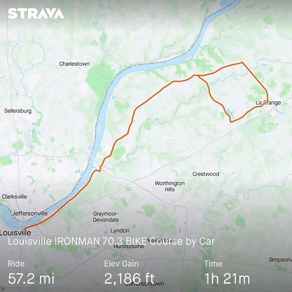
IRONMAN 70.3 Louisville begins with a 1.2-mile down river swim in the Ohio River. The first transition is on the Great Lawn in Waterfront Park. The 56-mile bike course heads east on River Road to the rolling hills of Oldham County, then proceeds back down River Road to the second transition. The 13.1-mile run goes through several parks and returns downtown to an iconic finish at Fourth Street Live.
The swim course is entirely downstream and starts behind Towhead Island and then enters the main Ohio River channel.
Click on a thumbnail photo to enlarge.
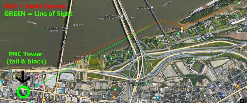
Once clear of Towhead Island and out into the main Ohio River channel, look through the upper structures of the bridges for the black PNC Building in downtown Louisville.
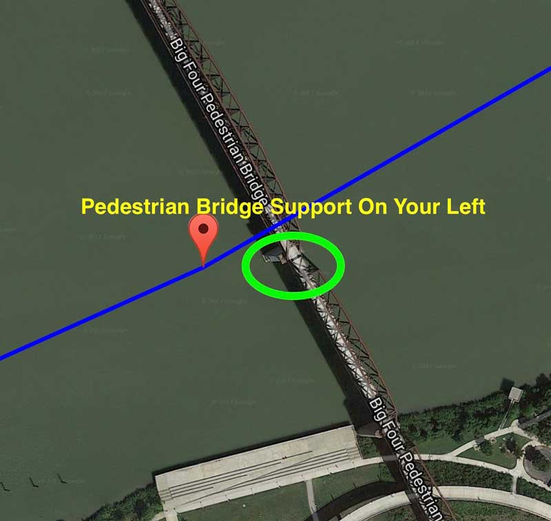
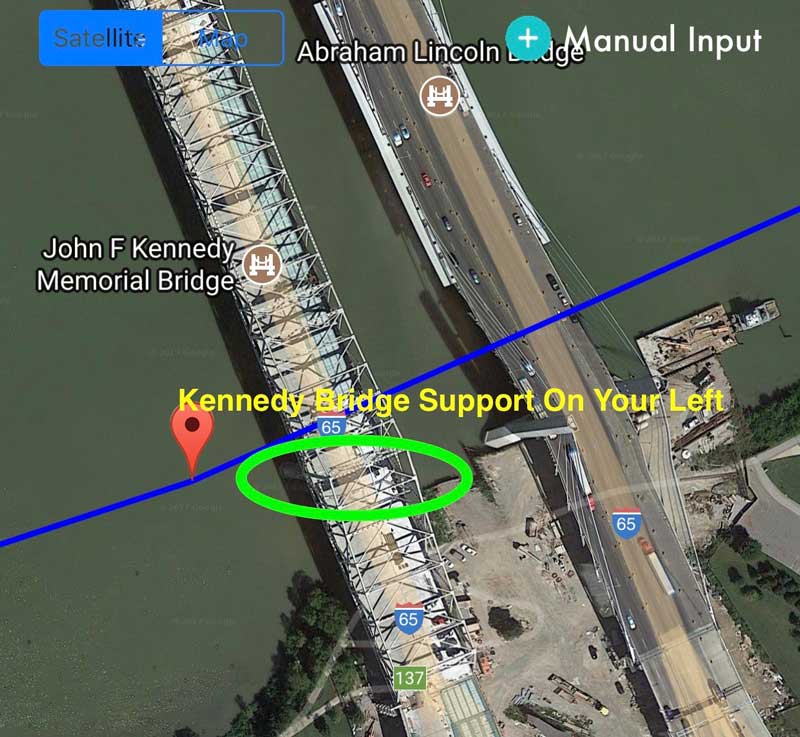
The Big Four Pedestrian Bridge will be the first bridge encountered on the swim course. Sight the SECOND bridge support from the KY side and keep that support ON YOUR LEFT.
The Big Four Pedestrian Bridge will be the first bridge encountered on the swim course. Sight the SECOND bridge support from the KY side and keep that support ON YOUR LEFT. You can also see the tall, black PNC building in the distance for additional straight-line sighting (upper right corner of photo).
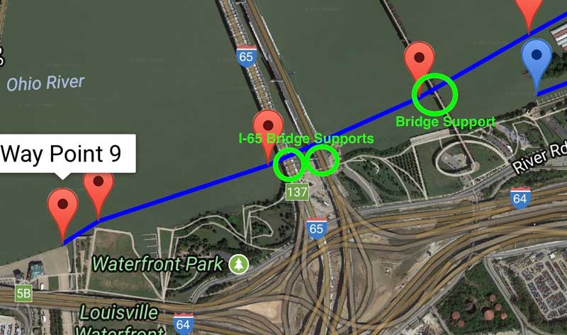
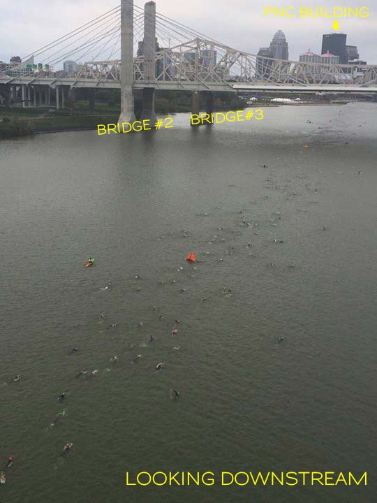
The second and third bridges encountered both support I-65. The supports for both of these bridges are quite close to the KY shoreline. Therefore you will want to keep them on your left.
Here is a zoomed-in view of the I-65 Bridge supports
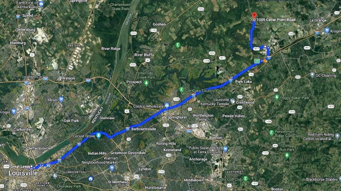
You may want to bring chairs and drinks. This area is normally shaded. The cyclists will be about 25 miles into their bike ride at this point. They will be riding up a short hill so their speed will be a bit slower and you might have an opportunity to have a brief conversation with your athlete. Reverse the directions to be back downtown.
Google Maps indicates a 23.6 mile/28 minute drive, so plan your time accordingly.
Download Written Directions to Bike Course Viewing
BarryS Coaching will be breaking out the BarryS Coaching Party Tent on IRONMAN Louisville 70.3 Race Day. We will be based at the corner of Payne and Spring Street. (This is across the street from Spring Street Bar - we will be set-up in the Payne Street Bakehouse Parking lot). Runners pass this location two times; about miles 2 and 11.
Please come join us in cheering on all the runners. I'll hope to be set-up between 9 - 9:15 a.m. race morning.
The LARGER the crowd we have at Payne and Spring Street, the better. Beer and bathrooms are across the street; coffee and sandwiches are right next door, and both places have agreed to let us use their restrooms.
Copyright © 2011-2026 BarryS Coaching, LLC. All rights reserved.Privacy PolicySitemap